
Integrating drones, remotely piloted aircraft, with the national air traffic management system is the aim of the URANO research project, funded by the Italian Space Agency (ASI), recently presented at the airport of Grottaglie, Taranto.
The project, now in the flight test phase, was funded by ASI with the technical-operational support of ENAV, and implemented by Telespazio, a joint venture between Leonardo (67%) e Thales (33%), in collaboration with Leonardo. Specifically, URANO involved the design, development, verification and validation of a prototype system aimed at experimenting with and demonstrating the benefits of using satellite navigation systems for drone missions integrated into the national air traffic management (ATM) system.
The research activities were carried out by Telespazio and Leonardo with the support of Planetek and Distretto Tecnologico Aerospaziale (DTA). ENAV participated with monitoring and technical revision activities.
Specifically, the project is intended to promote, through the use of global navigation satellite systems (GNSS), such as GPS, EGNOS and Galileo, the inclusion of remotely piloted aircraft with take-off weight greater than 150 kg used in civil operations into the national air traffic management system.
“This is a research and development project aimed at testing technology and operations useful for future scenarios which will see drones, RPAS and UAS share the airspace with piloted aircraft, and thus fully integrated with air traffic control. We are talking about large drones with considerable endurance capacity and very high reliability for monitoring, surveillance and civil protection missions,” said Mario Musmeci, Senior Expert GNSS for ASI and Technical Manager of the URANO project.
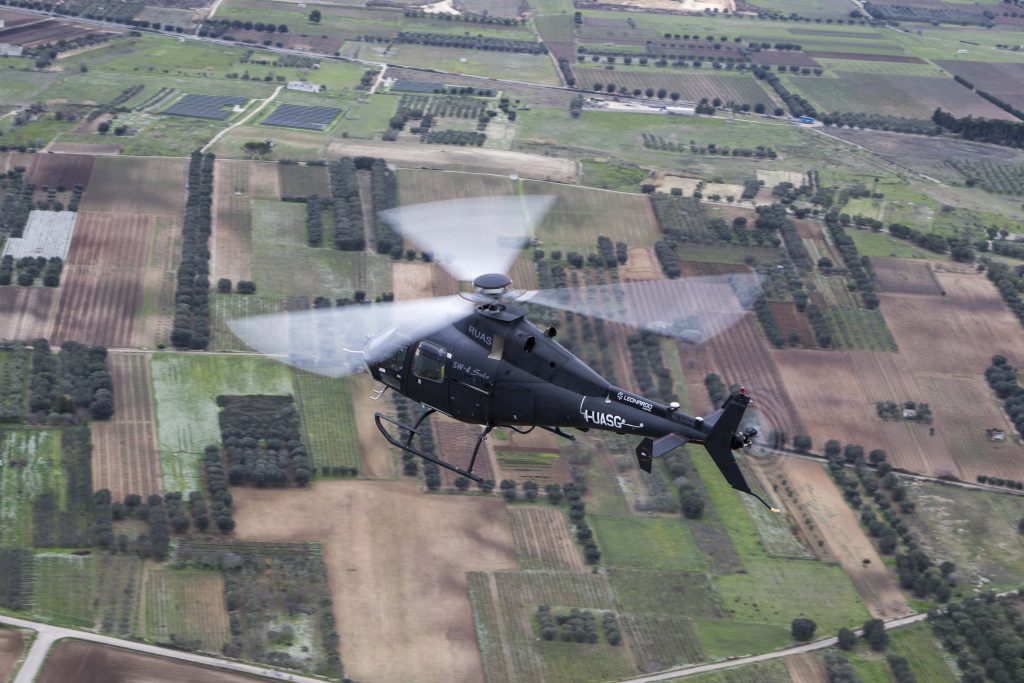
Flight tests were carried out with Leonardo’s remote-controlled SW-4 Solo helicopter. The multirole manned/remote piloted demonstration craft enabled the development and customization of instruments such as the Virtual Cockpit, an interface which may be used to monitor GNSS performance during drone operations; the GNSS Monitoring Tool, used to monitor the performance of navigation systems in geographic areas of interest; the integration of signals from the drone and the integration of GNSS parameters on the platform used for air traffic control operations.
The results of the activities carried out show that both the GPS/EGNOS system and Galileo, Europe’s satellite navigation system, ensure levels of safety appropriate for the services that can be developed using the remotely piloted aircraft considered in the project.